King (William)
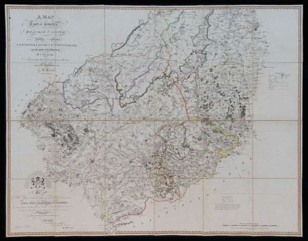
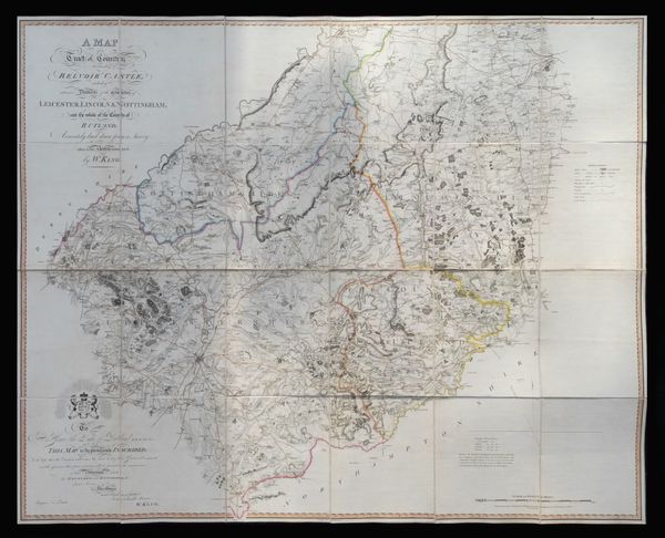
King (William) A Map of a Tract of Country surrounding Belvoir Castle including Extensive Districts of the Counties of Leicester, Lincoln & Nottingham and the whole of the County of Rutland accurately laid down from a Survey taken in the Years 1804, 5 & 6, engraved map with hand colouring, 114cm x 143cm overall, dissected and laid to cloth, with slipcase